Day 11: Travel by train & bus to Rodi & walk to Faido. Travel by train to Lavorgo & walk to Giornico. Travel by bus & train to Bellinzona (MAPS 3 & 4).
After breakfast they headed to the railway station of Airolo (1141m a.s.l.), which is the highest railway station of the Swiss Federal Railways (SBB) (BAHNHOF AIROLO). There they boarded the "Treno Gottardo" to Faido. In Faido they changed to a bus and got off at Rodi "Dazio Grande".
The "Dazio Grande" is a building from the middle of the 16th century. It served as customs house for goods, transit traffic, hoarse-changing station, guesthouse, hostel and warehouse until 1803, the year when the Ticino became part of the Swiss Confederation. It remained in operation, until the Gotthard railway line was inaugurated in 1882. Nowadays, it is still open for the public as a museum and provides a rustic restaurant and overnight accommodation (DAZIO GRANDE).
From there they started their hiking, which took them along the "Via Gottardo Süd", passing by the two most impressive gorges ("Piottino" and "Biaschina"), which are shaping the landscape of the upper Ticino, and ending by the village Giornico.
Day 11: Travel by train & bus to Rodi & walk to Faido. Travel by train to Lavorgo & walk to Giornico. Travel by bus & train to Bellinzona (MAPS 3 & 4).

Figure 21: Walking through the forest by the lakeside in Pfäffikon SZ


Figure 22: I am sitting in the Voralpen-Express on my journey from Rapperswil to Arth-Goldau, enjoying a sea of fog
Upper picture was taken between Pfäffikon SZ and Biberbrugg
Lower picture between Rothenthurm and Arth-Goldau

Figure 23: Golden autumn in Einsiedeln
Left picture shows the monastery of Einsiedeln
Right picture the "Sihlsee" lake in the back

Figure 24: On my hiking tour through the "Klosterwald" forest in Einsiedeln hearing the sound of leaves rustle

Figure 25: Advent market in the "Klosterplatz" square in Einsiedeln with a pre-winter snow greeting

Figure 26: View from the "Hageggli" hill (805m a.s.l.) to the village of Sattel. Way in the back the pre-alpine hills and Central Swiss Alps rising up from the sea of fog

Figure 27: Hiking tour from Steinerberg to Goldau along the track of ancient landslide.
Left picture: A view to the valley of the "Lauerzersee" lake. On the left side the peak of "Mythen" mountain protruding out of the colored mixed deciduous and coniferous forest. On the right side are the Central Swiss Alps.
Right picture: Several cows welcomed me on my hiking tour.

Figure 28: View to a wide-ranging sea of fog from "Rigi Kulm" (1797m a.s.l.)

Figure 29: I discovered an impressive silver thistle along the hiking track from "Rigi Kulm" (1797m a.s.l.) to "Rigi Klösterli" (1302m a.s.l.)

Figure 30: "Rigi Klösterli" (1302m a.s.l.): Deciduous trees standing out by their bright yellowish colors in the middle of the coniferous trees

Figure 31: Dropping foliage of fruit trees on a plantation near the village of Arth am See with view to the "Rossberg" mountain

Figure 32: Nature Reserve "Lauerzersee-Sägel-Schutt"

Figure 33: The "Seerosenweiher" pond reflecting the different colors of the surrounding deciduous forest

Figure 34: A gray sky over the village of Lauerz and the "Lauerzersee" lake. In spite of it, we can still enjoy the distinct pyramid shaped peak of the "Mythen" mountain way in the back

Figure 35: On a rainy day, view from the village of Seelisberg to the "Urnersee" lake with the small towns of Ingenbohl and Schwyz in the valley basin. Way in the back we can spot the peaks of the "Mythen" mountains

Figure 36: Walk along the "Reuss" river from Erstfeld to Attinghausen.
Left picture shows the village of Erstfeld
Right the village of Attinghausen

Figure 37: The castle ruin of Attinghausen, which dates back to the year 1100 and is located on a rock hill above the "Reuss" plain. In the back we can see the snow-covered "Glarus" Alps

Figure 38: The "Telldenkmal" monument in the center of Altdorf was created by the sculptor Richard Kissling and inaugurated in 1895.
The monument was made to commemorate the Swiss national hero "Wilhelm Tell"

Figure 39: Hiking tour from Göschenen direction to Wassen along the Gotthard railway line. Along the path there are several larch trees with their distinct yellow needles

Figure 40: The village of Göschenen in late autumn, discolored deciduous trees alternate with evergreen coniferous trees

Figure 41: The famous tourist resort Andermatt with view direction to the "Oberalp" pass

Figure 42: Journey with the post bus over the Gotthard pass, on the 14th of October 2021, shortly before end of the season (when the pass closes during the winter)

Figure 43: Enjoying a golden October day on my hiking tour between Airolo and the "Val Canaria" valley

Figure 44: Hiking through the almost leafless chestnut forest in late autumn from Faido to the "Madonna delle Rive Santuario" church

Figure 45: The powerful "Piumogna" waterfall in Faido

Figure 46: Picture taken from a bridge on my walk along the "Ticino" river from Lavorgo to Fusnengo in a beautiful autumnal woodland

Figure 47: Hiking in late autumn, over the fallen chestnut fruits and leaves of the "Selva di Nivo" forest from Nivo to Chironico

Figure 48: Chironico in late autumn with lots of deciduous forests in their yellow shades. In the back we see the snow-covered mountain peaks

Figure 49: The castles "Castelgrande" (left picture) and "Montebello" (right picture) in Bellinzona in the bright-colored autumn landscape

Figure 50: Fall foliage surrounding the "Sasso Corbaro" castle in Bellinzona

Figure 51: Heavy rainfalls on Switzerland's "sun lounge" on October 3 & 4 2020, causing high lake water overflowing up to the promenade in Minusio

Figure 52: Lots of golden oak leaves covering the beach in Minusio on an Indian summer day

Figure 53: Treno Gottardo traversing along the colorful lake promenade in Minusio

Figure 54: Through the autumnal forest, view to the "Madonna del Sasso" church in Orselina

Figure 55: Going down a narrow path with lots of fallen leaves from Orselina to Minusio with view to the "Magadino" plains

Figure 56: "Camelia" parc in Locarno in late autumn

Figure 57:A bed of mushrooms covering the sunbathing area of the Camping Delta in Locarno

Figure 58: The "Maggia" river from Losone "Ponte Maggia" to the estuary.
Left picture shows the "Maggia" river at Losone "Ponte Maggia"
Right picture the estuary of the "Maggia" river and view to snow-covered peak of "Pizzo di Vogorno" (2442m a.s.l.). Way in the back we see the "Magadino" plains.

Figure 59: "Terreni alla Maggia" wine yards after vintage
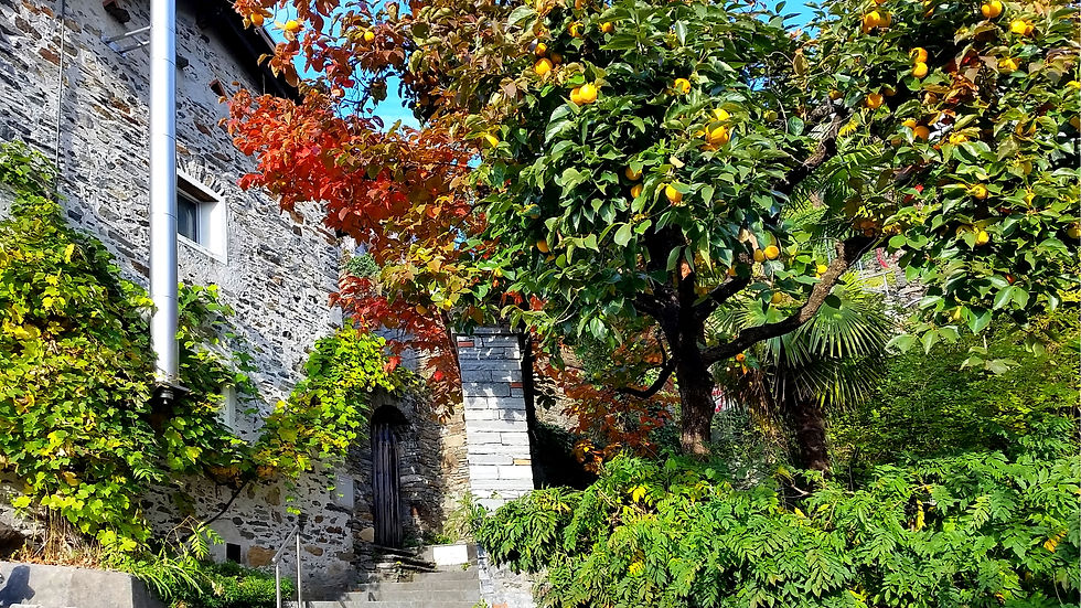
Figure 60: Hiking track from Ascona to the "Monte Verità", passing through an avenue with a beautiful khaki fruit tree

Figure 61: View from the "Monte Verità" to Ascona and the "Maggia" delta. In the foreground stands an impressive maple tree with its beautiful reddish leaves

Figure 62: The lakeside of Ascona in late autumn still having a mild climate

Figure 63: On the hiking track from Ronco to Ascona I am collecting chestnuts!

Figure 64: The Islands of Brissagoa on an warm Indian summer day can be reached by boat