Day 11: Travel by train & bus to Rodi & walk to Faido. Travel by train to Lavorgo & walk to Giornico. Travel by bus & train to Bellinzona (MAPS 3 & 4).
After breakfast they headed to the railway station of Airolo (1141m a.s.l.), which is the highest railway station of the Swiss Federal Railways (SBB) (BAHNHOF AIROLO). There they boarded the "Treno Gottardo" to Faido. In Faido they changed to a bus and got off at Rodi "Dazio Grande".
The "Dazio Grande" is a building from the middle of the 16th century. It served as customs house for goods, transit traffic, hoarse-changing station, guesthouse, hostel and warehouse until 1803, the year when the Ticino became part of the Swiss Confederation. It remained in operation, until the Gotthard railway line was inaugurated in 1882. Nowadays, it is still open for the public as a museum and provides a rustic restaurant and overnight accommodation (DAZIO GRANDE).
From there they started their hiking, which took them along the "Via Gottardo Süd", passing by the two most impressive gorges ("Piottino" and "Biaschina"), which are shaping the landscape of the upper Ticino, and ending by the village Giornico.
Day 11: Travel by train & bus to Rodi & walk to Faido. Travel by train to Lavorgo & walk to Giornico. Travel by bus & train to Bellinzona (MAPS 3 & 4).
Day 6: Walk from Rapperswil to the "Lützelsee" lake. Visit the "Lützelsee" lake & walk to Wetzikon through the drumlin landscapes of the "Zurich Oberland". Return back to Rapperswil by train.
After breakfast, all were set, ready and fit to start their journey. For their first destination "Lützelsee" their walking track took them through different fields, starting at the "Meienberg" (Figure 22), a small hill shaped by "Nagelfluh" from the glacial period (MEIENBERG).
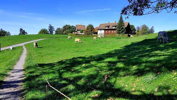
Figure 22: "Meienberg" hill by Rapperswil
Next, they continued through a gently sloping terrain. They reached their destination on time without using much energy.

Figure 23: "Lützelsee" lake
The "Lützelsee" (Figure 23) is an important nature reserve in Canton Zurich and is home to rare, endangered, protected animal and plant species. It is a "kettle hole pond" and has also been produced by the "Linth-Rhein" glacier during the Würmian ice age like the "Egelsee" and "Mettmenhaslisee". Its surface is about 12.8ha (LÜTZELSEE). The whole group went for a swim, before having the picnic lunch. The refreshing water of the lake was a blessing on this rather hot day.
After the break they started their walk to the next destination, the town of Wetzikon, which took them through the drumlin landscapes of the "Zurich Oberland" (Figures 24 and 25).

Figure 24: The S15 train passing through the drumlin landscapes of the "Zurich Oberland"

Figure 25: Natural pond in the drumlin landscapes of the "Zurich Oberland"
The drumlin landscapes of the "Zurich Oberland" (Figures 24 and 25) are among the most important nature reserves in the Canton, and harbor numerous endangered plant and animal species. From the total area of almost 9km2, around 1.2km2 is protected by fens and raised bogs as well as extensively used meadows. Pro Natura Zurich has owned almost 38ha of these since 1970. The landscape is characterized by an area of elongated, streamlined hills and valleys crossing in between. This landscape was created in the last ice age between 100'000 and 10'000 years before our time. The glacier left behind extensive, wet depressions that gradually silted up.
The hills are built on gravel. With their almost parallel orientation, they reflect the original flow direction of the glacier (DRUMLINLANDSCHAFT ZÜRCHER OBERLAND). After this impressing landscape the group headed to the town of Wetzikon. From Wetzikon, they took the train back to Rapperswil and went for dinner.