Day 11: Travel by train & bus to Rodi & walk to Faido. Travel by train to Lavorgo & walk to Giornico. Travel by bus & train to Bellinzona (MAPS 3 & 4).
After breakfast they headed to the railway station of Airolo (1141m a.s.l.), which is the highest railway station of the Swiss Federal Railways (SBB) (BAHNHOF AIROLO). There they boarded the "Treno Gottardo" to Faido. In Faido they changed to a bus and got off at Rodi "Dazio Grande".
The "Dazio Grande" is a building from the middle of the 16th century. It served as customs house for goods, transit traffic, hoarse-changing station, guesthouse, hostel and warehouse until 1803, the year when the Ticino became part of the Swiss Confederation. It remained in operation, until the Gotthard railway line was inaugurated in 1882. Nowadays, it is still open for the public as a museum and provides a rustic restaurant and overnight accommodation (DAZIO GRANDE).
From there they started their hiking, which took them along the "Via Gottardo Süd", passing by the two most impressive gorges ("Piottino" and "Biaschina"), which are shaping the landscape of the upper Ticino, and ending by the village Giornico.
Day 11: Travel by train & bus to Rodi & walk to Faido. Travel by train to Lavorgo & walk to Giornico. Travel by bus & train to Bellinzona (MAPS 3 & 4).
Day 4: Travel by train to Niederhasli. Visit the "Mettmenhaslisee" lake & walk to Regensberg via Dielsdorf. Visit Regensberg & walk to Niederweningen via "Hochwacht". Visit the "Mammut" museum & return back by train to Rapperswil.
After a good night sleep and a rich Sunday breakfast they were ready for departure. Before leaving Daniela called M. Schneider and informed him about their intention to visit the "Mammut" museum in the late afternoon. Shortly before 10 o'clock they reached Niederhasli.
The community of Niederhasli, which includes the villages of Niederhasli, Oberhasli, Mettmenhasli and Nassenwil, has a population of about 9200 inhabitants and is in spite of its proximity to the city of Zurich in an intact and unspoiled nature with a wealth of flora and fauna (NIEDERHASLI).

Figure 10: "Mettmenhaslisee" lake with the "Lägern" mountain and Regensberg
The "Mettmenhaslisee" (Figure 10) has a surface of around 2.5ha and is since 1946 under nature conservation. The lake has a similar landscaping as the "Egelsee" in the "Zürcher Oberland", as it has also been produced by the "Linth-Rhein" glacier during the Würmian ice age. It is a famous local recreation area in the gently hilly landscape of the "Zurich Unterland" (METTMENHASLISEE).
The walk to the "Mettmenhaslisee" was very short; they just had to cross the street from the station. They stayed by the lake for a good hour, those who felt like taking a swim could do so, others preferred to have a coffee by the lido. As soon as they were ready, they started their hiking direction to Regensberg. They walked along the trail, going through several fields direction Dielsdorf.

Figure 11: Village center of Dielsdorf
Dielsdorf (Figure 11) belongs with a population of almost 6000 inhabitants to one of the most attractive villages in the "Zurich Unterland", characterized by its stylish village center with several old but well-kept timber-framed houses and unspoiled nature surrounding the village, which includes several biodiversity hotspots, e.g. the stork settlement (STORCHENSIEDLUNG; Figure 12). Due to its proximity to the Zurich International Airport and the city of Zurich it is a popular place for living and a good commercial center (DIELSDORF).

Figure 12: Stork settlement near Dielsdorf
By noon time, they arrived in Regensberg. The small village of Regensberg has a population of almost 500 inhabitants and is located on the most eastern rocky promontory of the "Lägern", at 600m a.s.l., high above Dielsdorf (REGENSBERG; Figure 13).

Figure 13: Village of Regensberg
The "Lägern" (Figure 14) is a wooded mountain chain and belongs to the easternmost foothills of the "Faltenjura". It runs in an east-west direction and its culminating point is the "Hochwacht", at 866m a.s.l (LÄGERN).
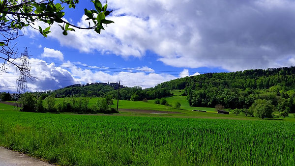
Figure 14: "Lägern" mountain chain
The small town of Regensberg was founded in the Middle Ages, in 1244, by the baron Lütold V. with the aim to gain control over the territory. The fortification includes a high round tower; water well, church, two town gates and 24 living units (REGENSBERG; Figure 13).
Unfortunately they had not much time to spend in Regenberg, so after a small picnic, they continued their walk, direction to the peak of the "Lägern", the "Hochwacht" (Figure 15).

Figure 15: View from the peak of the "Lägern", "Hochwacht", at 866m a.s.l.
The group was impressed by the clear view extending to the International Airport of Zurich, the lake of Zurich, the Prealps and all the way to the Glarus Alps and Central Swiss Alps. A lot of pictures and "selfies" were taken. Almost with regret they had to move downhill to their next stop in Niederweningen, which was a visit to the "Mammut" museum.
On their way to the museum, they passed by the swimming pool "Sandhöhli". Beatrice and the water lovers of the group, would have liked to stop by for a short break but they had to continue to make it on time for their tour organized by M. Schneider who awaited them at the entrance.
The political community of Niederweningen has a population of approximately 3000 inhabitants and has almost doubled in size since 1996. The village is the most western municipality of the canton Zurich and is located in the "Wehntal", which is a wide valley closed to the east by an old terminal moraine of the "Linth" glacier and forms a watershed between the rivers "Surb" and "Glatt" (NIEDERWENINGEN;
Figure 17).

Figure 16: Mammoth museum in Niederweningen
Niederweningen belongs to one of the most important sites of mammoth remains in Switzerland (Figure 16). In 1890, workers building the railroad through the valley discovered mammoth bones and those bones were housed in the zoological museum in Zurich. In 2003 a 45'000 year old complete mammoth skeleton was discovered not far from the one originally discovered in 1890. In 2005 a museum was established in Niederweningen to house the skeletons. Further findings in the clay layers, such as pollen, seeds, wood, moss and microorganisms, were evident for reconstructing the climate and living habitat during the ice age for the whole "Wehntal" valley
(MAMMUT MUSEUM).
The visit was a great success and after thanking their host they left, but before saying good bye Matthias Schneider told Daniela that he would be happy to hear from her again.

Figure 17: The "Wehntal" valley and S15 train leaving Niederweningen
In Niederweningen (Figure 17) they boarded again the white-colored double-deck train "Regio Dosto", the newest generation of the "Zurich S-Bahn" (REGIO DOSTO) and looked forward to travel along the whole S15 line. For a distance of almost 68km the journey took them 1hr 12min. They enjoyed the interesting and varied scenery they had already experienced during their hiking. The train stopped at several small stations, some having rather funny names, for example "Schöfflisdorf-Oberweningen", which attracted the attention of Tobias, who was interested in unusual locality names. There was effectively a wide field near the station, where a sheep herd was grazing. Between Oberglatt and Rümlang, Lukas, who had an interest in airplanes, could just spot one huge Airbus A380 aircraft of "Emirates" taking off on the runway of Zurich International Airport. At the station of Glattbrugg, Sandra out of habit almost wanted to get off. She grew up there and nowadays often visited her parents, who were still living there. Shortly after Zurich main station, the weather suddenly changed and a thunder storm would hit any time, hopefully they would be able to reach their destination before the rain starts. But it was not to be. Heavy rain started to pour down, fortunately it was a short thunderstorm and their hotel was just a short walk from the train station.
After a short rest they got ready for dinner. While they enjoyed their meal, Thomas informed the group that the next day will be a relaxing one on the island "Ufenau".