Day 11: Travel by train & bus to Rodi & walk to Faido. Travel by train to Lavorgo & walk to Giornico. Travel by bus & train to Bellinzona (MAPS 3 & 4).
After breakfast they headed to the railway station of Airolo (1141m a.s.l.), which is the highest railway station of the Swiss Federal Railways (SBB) (BAHNHOF AIROLO). There they boarded the "Treno Gottardo" to Faido. In Faido they changed to a bus and got off at Rodi "Dazio Grande".
The "Dazio Grande" is a building from the middle of the 16th century. It served as customs house for goods, transit traffic, hoarse-changing station, guesthouse, hostel and warehouse until 1803, the year when the Ticino became part of the Swiss Confederation. It remained in operation, until the Gotthard railway line was inaugurated in 1882. Nowadays, it is still open for the public as a museum and provides a rustic restaurant and overnight accommodation (DAZIO GRANDE).
From there they started their hiking, which took them along the "Via Gottardo Süd", passing by the two most impressive gorges ("Piottino" and "Biaschina"), which are shaping the landscape of the upper Ticino, and ending by the village Giornico.
Day 11: Travel by train & bus to Rodi & walk to Faido. Travel by train to Lavorgo & walk to Giornico. Travel by bus & train to Bellinzona (MAPS 3 & 4).

Figure 197: Timber-framed houses in the village of Niederweningen imbedded in the blooming spring vegetation. On the right picture a magnolia tree brings out the beauty of the house.

Figure 198: The "Wehntal" valley in Oberweningen in April with a cherry tree in bloom. On the left side way in the back the village of Regensberg

Figure 199: From the "Lägern" forest close to Regensberg a view to the Zurich Unterland and "Wehntal" valley, and the S15 passing through the fields

Figure 200: View from Regensberg to fruit plantations and rapeseed field. Way in the back one can identify the snow-covered Swiss Alps


Figure 201: The stork settlement in Steinmaur end of March, with two storks watching over their breeding nests (right picture)

Figure 202: Small pond near Steinmaur surrounded by the bright colors of fresh spring vegetation, the village of Regensberg way in the back

Figure 203: The "Neeracherried" wetland near Dielsdorf, is with a size of 105ha, one of the last large fens in Switzerland. It is of national importance, because it is a habitat for several birds, plants, amphibians, reptiles and small animals. On the right picture we can see a dense reed cover and a beautiful bouquet of red forest carnation (Silene dioica)

Figure 204: Walking through the alleys of the village center in Dielsdorf one can admire the variety of early spring blossoms surrounding the stylish timber-framed houses

Figure 205: Hiking track around the "Mettmenhaslisee" lake, left picture (starting point), right picture (end of track)

Figure 206: Picture taken from the S15 train between Dielsdorf and Niederhasli, showing a wide rapeseed field. In the back we see the small village of Nassenwil

Figure 207: Nature conservation centre "Pfäffikersee", which is in Pfäffikon ZH near Uster and situated in the largest moor landscape of Canton Zurich

Figure 208: Nature awakening in the "Robenhauserriet" wetlands

Figure 209: In the reeds of the drumlin landscapes "Zurich Oberland" one can find a diverse mosaic of flowering plants, for example Siberian iris (Iris sibirica) with its distinct purple petals

Figure 210: Orchids (Dactylorhiza maculata) and other flowers covering the fields by the lake shore of the "Egelsee" lake (Bubikon)


Figure 211: Meadows alternating with fruit plantations near Bubikon.
Upper picture an alpine panoramic view.
Lower picture a field with grazing cows.

Figure 212: The charming village center of Bubikon

Figure 213: Picture taken from the S15 train between Rüti and Bubikon, showing a field with dandelion and grazing cows. In the back we see the "Bachtel" mountain

Figure 214: Hiking track along the "Schwarzbach" river direction to Rüti, passing through a nature reserve

Figure 215: The "Tannertobel" is a ravine near Rüti, which is traversed by the "Jona" river. It is surrounded by a impressive and dense broad-leaved forest

Figure 216: Snail crossing the hiking path between Rüti and Jona

Figure 217: A circular hike (2.5km), along a mixed deciduous and coniferous forest near Jona. There one can see several scenes of nature.
On the left picture we can see the S15 train passing by.

Figure 218: Promenade along the castle wall of Rapperswil. It goes through a narrow path between several bushes, amongst others blackthorn (Prunus spinosa) with its beautiful white flowers

Figure 219: At Easter, terraces in the old town of Rapperswil reviving after their winter sleep.
Left picture shows the café "Rosenstädter".
Right picture the "Schlosskirche" church and the hotel "Jakob" on the right.

Figure 220: The harbor of Rapperswil, mallard duck family enjoying a swim

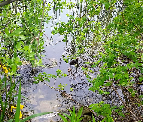

Figure 221: While walking on the famous wooden bridge from Rapperswil to Hurden, one can observe spring awakening.
Lower left picture shows a young coot, who tries to find his way in the thick shore vegetation.
Lower right picture shows a breeding grebe in the midst of the reeds.